If you have any questions, you can contact us directly by email: [email protected]
We have compiled answers to questions we are often asked - if something is missing, just contact us. There is also a manual that describes all the features of the MapOut app.
No, there are only two of us and we had to focus on one platform. An Android version is not planned and unfortunately we can’t give a recommendation for a similar Android app.
And beware: In the Android Store an Indian company offers an app with the same name MapOut. This app has nothing to do with us.
Please contact Apple - we are just suppliers to the AppStore. Only Apple knows that you have purchased MapOut and can help you with any problems with your purchase. The AppStore phone hotline is easy to reach and also free of charge.
No, there are no ongoing costs. You buy MapOut once and then use it as long as you want and on as many devices at once as Apple allows. Our first customers have been using the app for more than 10 years.
Only if you want to have your very own copy. However, you can use family sharing to download said family member’s version for free - as long as you’ve set up family sharing for your family in the Apple iCloud settings. Then, in the “AppStore” app, tap the “Account” icon in the top right corner. Under “Purchased” you will see all family members. Select the person who bought MapOut and then download their version - it doesn’t cost anything.
Yes, this is unfortunately very cumbersome - we also wish Apple had solved this in a simpler way.
MapOut can be run in English, German and French. The system chooses the language which is listed first in your system settings under “Preferred Language Order”.
In the newer system versions you can even choose the language for each app. In the system settings, you will find all installed apps on the first page and can select the language for each app in addition to the permissions.
We recommend to use the automatic migration from Apple. This will copy the MapOut app including tours to the new device. Even if you restore the new device with the backup of the old device, the tours will be restored.
You can also manually transfer the tours from the old device to the new one. For details see the description of export and restore a tour archive.
You can simply download the map data on the new device, then you have just those areas that you need up to date.
No, this is not necessary. MapOut app works only locally on your device - no server knows where you are and what you are planning. Your tours are stored only on your device.
The only thing we offer is a tour mailbox. This is an email address where you can send tours to be uploaded to the app. This service dates back to when there was no easy way to upload files to an iPhone app. Today with AirDrop and cloud apps, you can do that directly. But in some cases it’s still useful: for example, if it’s an exotic GPS file: the tour mailbox can convert many formats.
When it comes to the iPad, it should be noted that only the more expensive models with cellular coverage - recognizable by the SIM drawer - have a GPS receiver. The wifi models sometimes show location as well, but only if there’s a wifi network nearby that Apple knows the location of.
MapOut unfortunately doesn’t know about this difference, we get the position from the system’s location service. So, unfortunately, we can’t display a warning either.
It might be worth buying an external GPS receiver. Attention: this would have to be one that is marketed as “Made for iPhone” (with MFi logo), which is only the case for a few models. With this, all map apps will then work on the iPad.
MapOut only supports WGS84. We are only two developers and there are very many formats: the public inventory lists over ten thousand (!) different coordinate systems - see https://epsg.io
“Searching” doesn’t work, but you can mark it with a waypoint. To do this, select the “Waypoint” function in the “Record Menu” and then type the coordinates into the fields above. The marker will then jump to the specified location. To specify the direction you can use either +/- signs or N, E, S, W. For example -47° 12’, 47° 12’ S, -47 12 or S 47° 12’, we try to understand almost every format variation. You can also omit the special characters ° ’ “.
For recorded or imported tours, we calculate the elevation using the terrain grid we have on the device. The value should be taken with caution, because the grid of the terrain data is rather coarse. Small hills and ditches fall through the grid and we therefore usually underestimate the elevation meters of hikes in such terrain. For larger roads, on the other hand, our figure tends to be too large, because these roads are always flatter than the terrain - cut into or filled in.
For tours drawn in MapOut, the value is a bit better, because then the type of road is known and bridges or tunnels are mapped correctly. The same applies if you have “snapped” a recorded or imported tour in MapOut’s drawing tool onto the path network. Then the estimation should be accurate to about 10%. We can’t do better offline with the freely available data worldwide.
Actually yes… and it is always active. MapOut is consequently trimmed to save power. Thanks to the offline maps, for example, there is no energy consumption for cellular transmissions.
If you want the battery to last even longer - here are a few tips:
All of MapOut’s features work with the map data stored on the device. So after downloading, you’re never dependent on how fast the internet is - and whether you have reception at all. Even when searching and planning a tour, you don’t have to access the Internet. You also never have to decide which map areas should be available offline.
A tip for loading larger areas: if you zoom out of the map, the selection grid becomes coarser. Use this to quickly select larger areas and then zoom in to correct the details of the selection.
Select “Download Map Data” in the menu, select the area in question and then tap on “Delete” in the lower left corner.
Simply download the desired area again. For example, you can update the data before you travel to that area.
You can also select 
![]() Map Data
Map Data ![]() Update All Map
Data, then all installed maps will be updated.
Update All Map
Data, then all installed maps will be updated.
There seems to be a download “stuck”. You can stop it by selecting the menu item that is normally called “Download Map Data” and now shows the progress. This menu item works as a stop button during an active download.
No, MapOut does not provide a satellite view. We want to store all information for offline use on the device, which would be extremely storage-intensive for high-resolution imagery. In addition, we depend on freely available material worldwide and we don’t know any source for good aerial images.
MapOut displays the map image from vector data - i.e. from the coordinates for all roads, paths, … which we get from “OSM”, the OpenStreetMap.org project (a big thanks to all contributors there!). So the app knows what is where. This enables all the features like drawing tours and offline search.
Other freely available map imagery, on the other hand, is usually only available as pixel images. If we were to display one, the drawing and search functions would no longer be available or would be based on OSM instead of the displayed map, which would be very confusing.
However, we offer “map overlays” where we highlight bike routes, hiking trails, tourism, public transport route network, …
MapOut draws the map from the data of the OpenStreetMap.org project - it’s a collaborative effort similar to Wikipedia, but for a world map. On the OpenStreetMap.org website there is a button in the right sidebar to attach comments to the map (speech bubble with a small plus next to it).
You can also change the error directly in OpenStreetMap - for that you need a free account there and you can adjust the map directly.
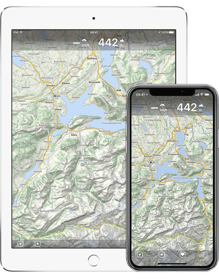
If you tap on the unit, the display switches between the two representations.
Tap on in
the bar below to see the menu with the functions and the display
options. There you will find an option to hide or show all tours,
respectively to hide the “other tours” if one is selected.
We’d rather leave our hands off door-to-door navigation in road traffic. The “big guys” Google and Apple (TomTom) do that much better and for free anyway. Accordingly, Car Play support would raise false expectations. MapOut is rather the “bike and hiking app”.
From our side with pleasure. But please note that the map image is based on the data of the OpenStreetMap.org project, which would have to be credited with “© OpenStreetMap contributors” in case of “reproductions”.
First of all: if you want to navigate from A to B in the traffic, we recommend to use one of the “big” services Google or TomTom (in Apple Maps). They do it much better than we could ever do with the offline available data and for free. MapOut is aimed at cyclists and hikers - you can use it to draw routes off the beaten track on the map and then use the drawn route as a guide on your trip.
If you’re looking for the spoken turn-by-turn button - it’s not there yet, but it’s planned.
We call planning a tour “drawing” because it happens on the map and is not aimed at the fastest door-to-door route, but is also good for planning detours. This “drawing board” metaphor may take some getting used to, but it opens up new possibilities.
Many websites offer trails as GPX files for download. You can add such files to your tour collection in MapOut by doing the following:
Unfortunately not yet - we are working on it. Until that’s done, you can create a backup of the tours in the settings under “Tour Organizer” and then load the zip file to the new device and open it with MapOut.
Or a bit more detailed: when you create the backup, you will be asked where to put it - then it’s best to go to “Backup to Files” and select iCloud Drive as the destination. Then on the target device, launch the Files app, find the file MapOut-Backup-<date>.zip and long tap on it. In the menu that appears, select “Share” and then select MapOut as the destination.
The system actually keeps a register of which installed app can work with which file types. Unfortunately, there are problems with this when different apps define a file type - in this case, the one ending in “gpx” - differently. Unfortunately, it’s difficult to determine which app you would have to delete to fix the conflict.
Most of the time you can save the file in question in the Files app and then pass it from there to MapOut.
To save the tour collection, select the “Backup Tours” function in the settings under “Tour Organizer”. This creates a zip-archive with all tours as gpx-files inside and presents a “share-sheet” for saving or sending the archive.
To import the zip archive, proceed as with “Import Tour”.
You may still find the mailbox address in the emails you sent - it’s in the format <mailbox>@mapout.me.
The password reset email will be sent to the address you specified when you created the username - you may no longer have access to this account or you may not have specified one at all - in this case you can contact us.
In case of problems with the login we recommend you to create a new one if you really need it - it is only a mail forwarding function and not a tour storage, so nothing will be lost.
No. The “Login” is only used for the “tour mailbox”, which is the email address you can send tours to in order to automatically load them into the app. This service dates back to the days when there was no way to upload files to an iPhone app. Today, with AirDrop and cloud apps, you can do that directly.
However, it is still useful in some cases: for example, if it is an exotic GPS file (the tour mailbox can convert many formats) or if on the iPhone the mapping of document types to apps got messed up and AirDrop or the sharing feature no longer offer MapOut as a destination.
Please note that Mailbox only stores the “mails” briefly and is not a cloud storage for your tours. The tours are stored solely on your device. They are backed up with the iPhone backup. You can additionally or if you don’t have a backup of the whole iPhone, create a backup manually. In the settings in MapOut you can find the function “Backup Tours” under “Tour Organizer”.
MapOut has been around for more than 10 years, and our loyal community continues to be one of our biggest joys. Every now and then, someone asks if we accept tips. While it’s absolutely not expected, we truly appreciate the gesture!
If you’d like to support us, you can send a tip via PayPal or with Revolut. Prefer a regular bank transfer instead? Just let us know — we’ll be happy to share the details.
And of course, a kind review on the App Store means the world to us. If you have a moment to spare, it will definitely warm our hearts!